
Autodesk and Leica Geosystems are focused on bringing more efficiency to the building construction industry with integrated technologies that enable construction professionals to implement streamlined workflows.
Streamlining construction workflows helps to optimize efficiency and increase transparency both on the jobsite and in the office.
![]()
Integration for Laser Scanning
Leica CloudWorx for AutoCAD
Leica CloudWorx for AutoCAD is the most efficient and popular plug-in software for using as-built point cloud data captured by laser scanners.
Users can create accurate 2D and 3D as-builts, check proposed designs against existing conditions, perform critical construction & fabrication QA, and more directly within AutoCAD.
The powerful TruSpace intuitive, panoramic viewing window lets users “see” better what the point cloud represents, and acts like a super-control to drive point clouds visualization in AutoCAD with unprecedented speed.
Leica CloudWorx for Revit
Leica CloudWorx for Revit is a breakthrough plug-in for efficiently using rich as-built point cloud data, captured by laser scanners, directly within Revit for simpler and faster BIM modeling of existing buildings. This is useful for a wide range of BIM activities including retrofit design, construction and operations, and lifecycle asset management of the building. It provides a virtual visit to the site within Revit with a complete view of the captured reality.
Additional tools in CloudWorx for Revit provide for accurate fitting of steel, flanges, pipes, and 2D lines, or placement of walls, floors, structural members, doors, windows, mechanical equipment, and more. And CloudWorx for Revit allows direct import of COE models from Cyclone, and/or export of Revit models as COE. This allows users to bring light-weight Revit-created models into Cyclone for additional analysis or publication of the models in TruViews.
Leica CloudWorx for Navisworks
Leica CloudWorx for Navisworks is a new plug-in software for using as-built point cloud data – captured by laser scanners – directly within Navisworks. Users take advantage of the familiar Navisworks interface and tools to shorten the learning curve for working with laser scan data.
Leica CloudWorx for Navisworks a provides greatly improved point cloud rendering environment resulting in a much improved user experience, unlimited size project scale and greatly improved productivity, on the order of a 50% improvement over the built in capabilities.


Pointfuse powered by Jetstream
Pointfuse powered by JetStream (PPJ) Standard is a powerful modeling engine that enables the quick and easy conversion of LGS point clouds into reality models, delivering intelligent meshes into existing Digital Construction and Visualization workflows.
Taking away the heavy technical lifting of an expert CAD technician, PPJ Pro uses smart automation to convert point cloud data into professional 2D and 3D outputs in a matter of minutes aiding users in Space/Facilities Management.
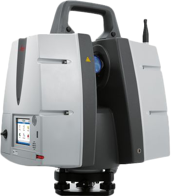
Compatible Leica Geosystems’ Laser Scanning Devices
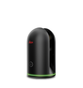
 Leica BLK2Go
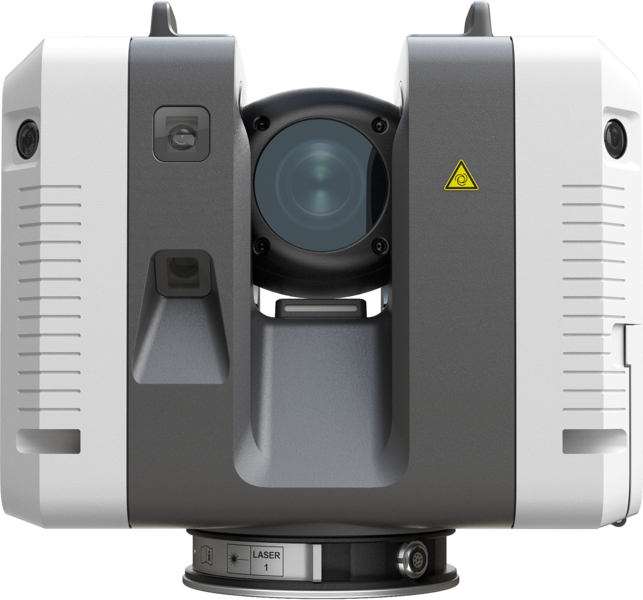
Peer Insight: Maxwell Construction Co.
As-Builts from Point Clouds: How Maxwell Construction Is Advancing Building Documentation
Workflow: Reality Capture for As-Built Documentation
Integration: Autodesk AutoCAD, Cloudworx for AutoCAD
Product Used: BLK360 Imaging Laser Scanner
Videos: Laser Scanning Integration
VIEW ON-DEMAND
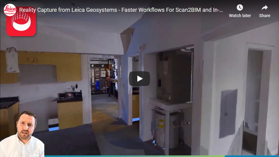
Faster Reality Capture Workflows for Scan2BIM and In-Field Construction Verification
- Quickly and easily create Scan2BIM/Plan models using PointFuse, powered by Jetstream
- Develop 3D models for as-built office verification including clash and anti-clash analysis
- Leverage plug-ins like Rithm, for real time in-field verification of concrete floor flatness and levelness
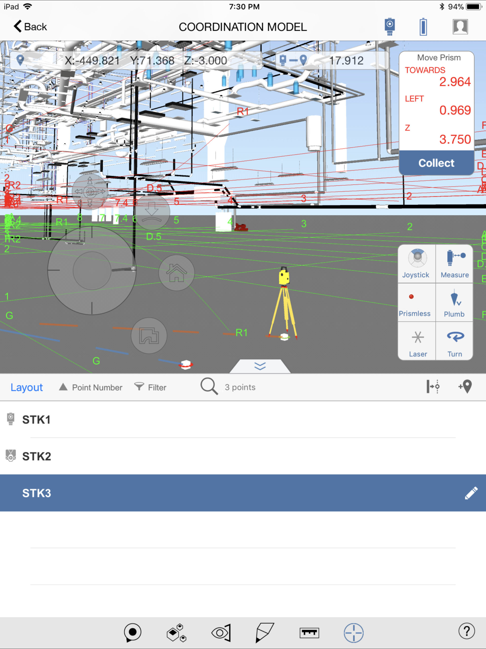
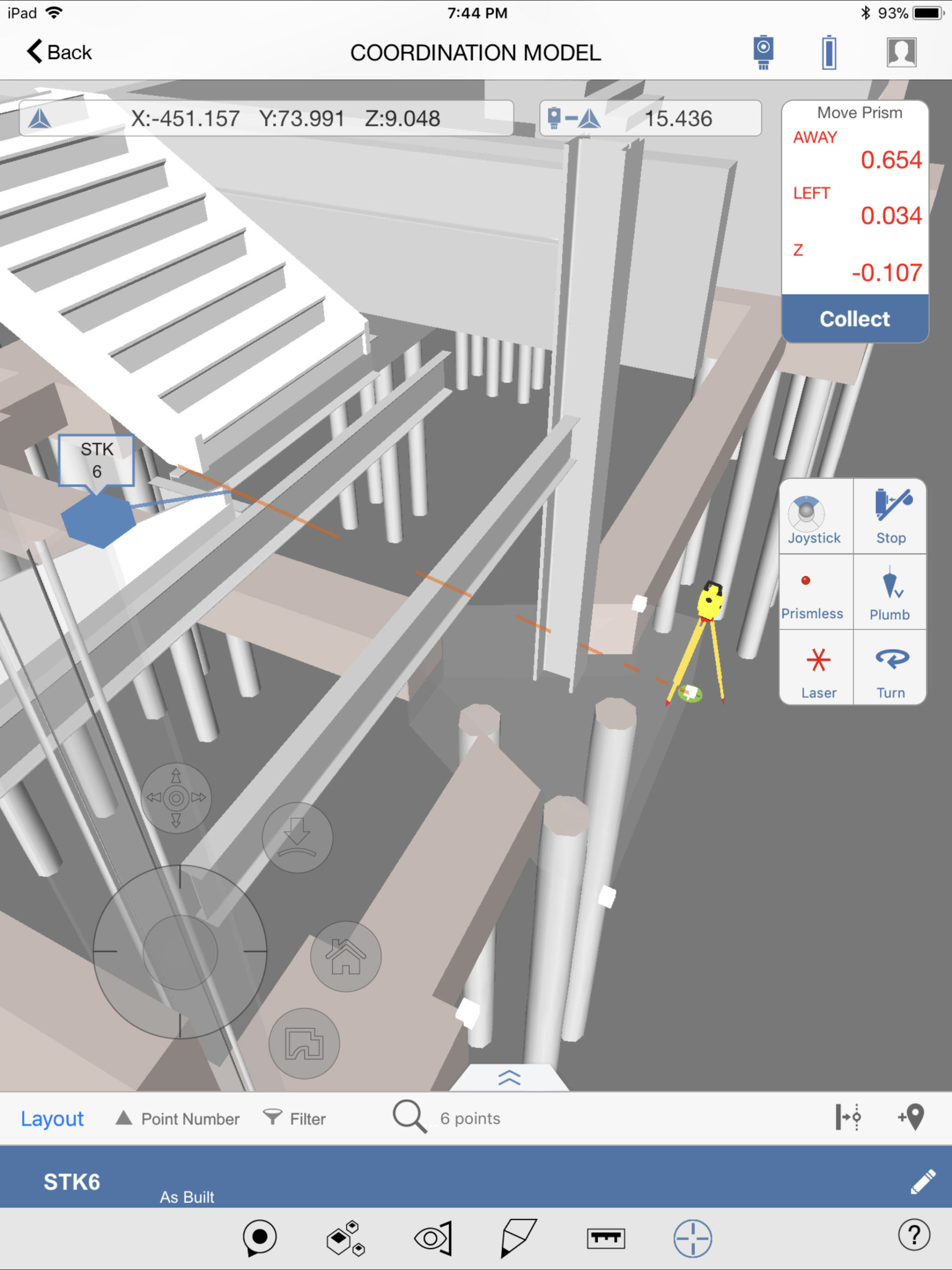
Integration for Layout
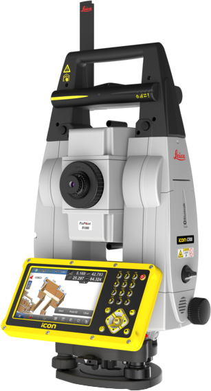
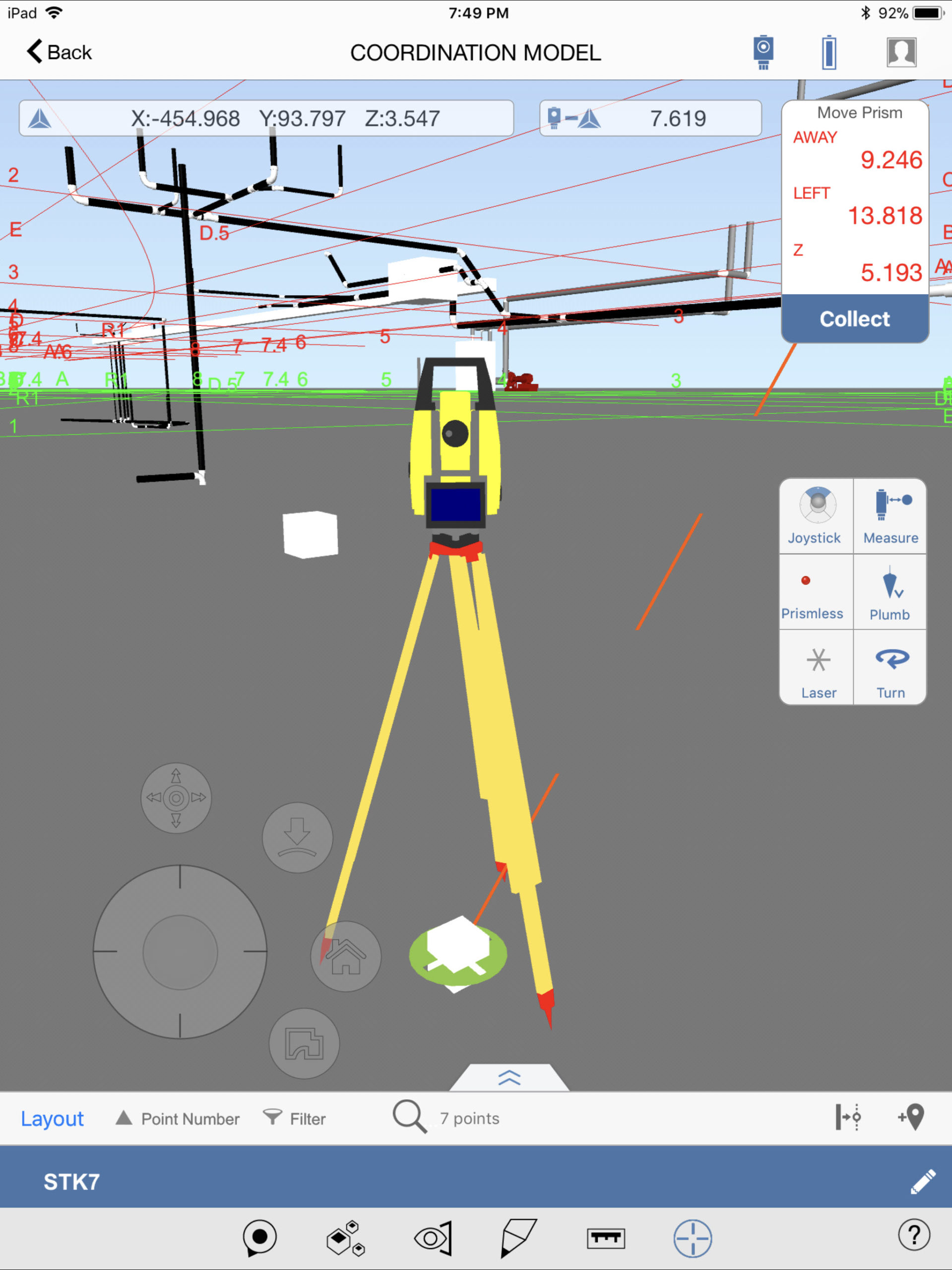
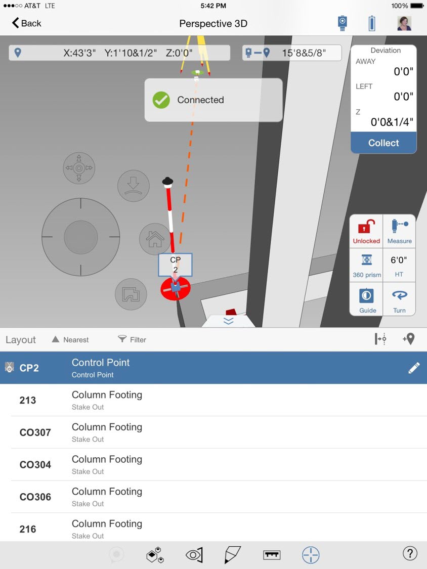
Autodesk BIM 360 Layout + Leica iCON Sensors
The Autodesk BIM 360 Layout app for iOS/Android provides construction contractors the ability to connect the coordinated model to the field layout and verification process through a direct connection with Leica iCON total station sensors.
This seamless workflow sends positions from the robotic total stations to the mobile app to compare design data, increasing efficiency and productivity from field to office. BIM 360 Layout for iOS customers will be able to accomplish important layout and quality assurance and quality control (QA/QC) tasks by using models stored and coordinated in BIM 360 directly within the BIM 360 environment.


 Leica iCR80
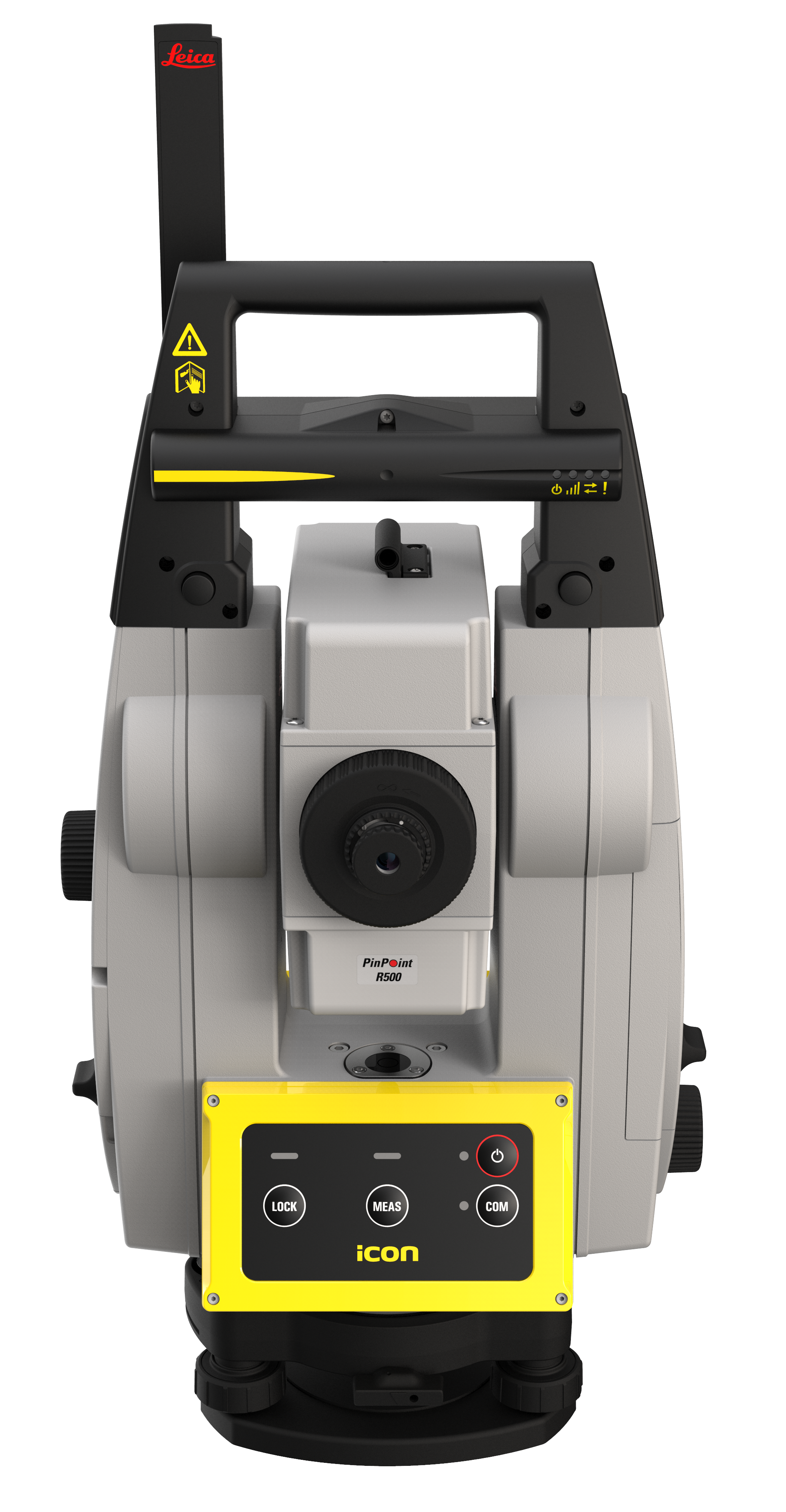 Leica iCR70
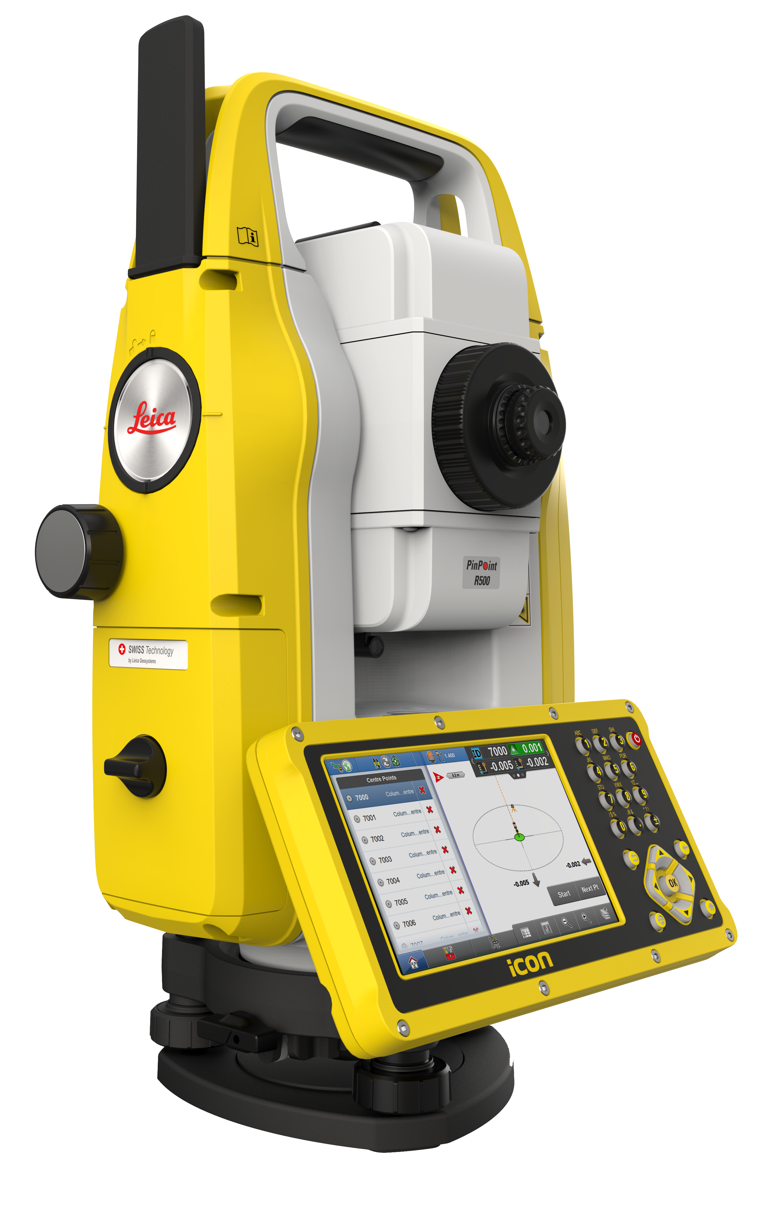 Leica iCB70
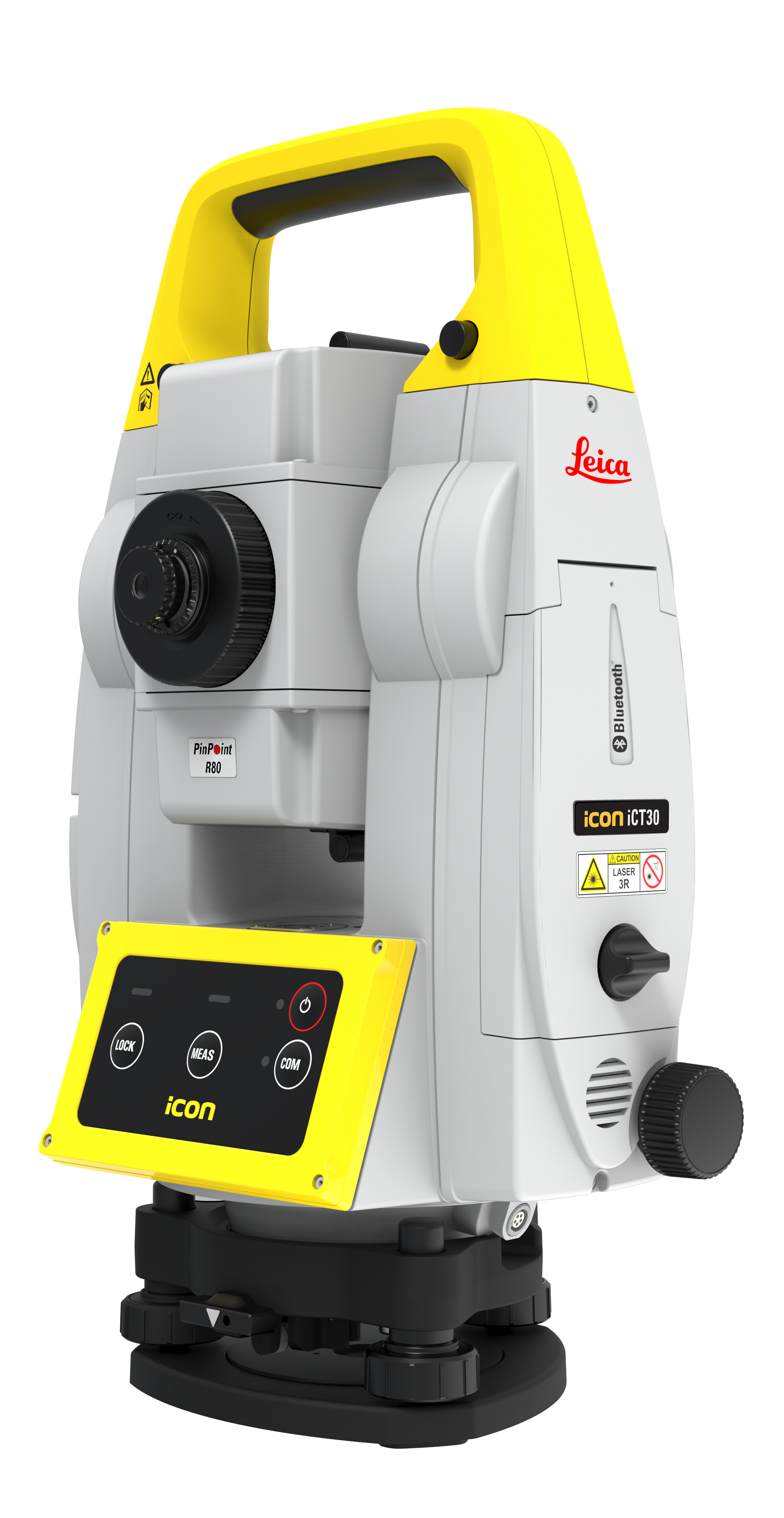 Leica iCT30
Peer Insight: CECO Concrete Construction
No More Waiting for Points: CECO Concrete Construction Saves Time and Money with Robotic Total Stations
Workflow: Formwork Layout from 3D Model in Field
Integration: Autodesk Revit, Autodesk Point Layout
Product Used: iCON Robotic Total Stations
Video: Exporting to Leica Project from Autodesk Point Layout
Integration for Documentation
Connect to Autodesk BIM 360 Docs
Leica Geosystems and Autodesk BIM 360 Docs customers can streamline construction workflows to optimize efficiency and increase transparency both on the jobsite and in the office. By connecting Autodesk BIM 360 Docs, a leading construction management platform, with Leica Infinity or iCON field software, customers will be able to create seamless workflows between office and field.
Connect via Leica iCON Field Software
Leica iCON field software offers you an entirely new work experience. Its innovative, straightforward software design, smart workflows and easy-to-understand user interface make work a pleasure and increase your productivity on site. iCON field software is specifically designed for construction helping you complete your various applications fast and easily on site.
Connect via Leica Infinity
Infinity is the user-friendly geospatial office software suite for the measurement professional. It is designed to manage, process, analyze and quality check all field survey measure data, including total stations, digital levels, GNSS data and Unmanned Aerial Vehicles (UAVs). So whether it’s measuring new survey projects or preparing data for construction layout jobs, Infinity supports your workflow.
BIM 360 Docs Workflow powered by BLK3D
The Leica BLK3D integration with Autodesk BIM360 Docs enables BIM 360 users to utilize BLK3D measurable images (.CMI files) in the issue creation and resolution workflow. Adding 3D images to issues provides a richer context for team members collaborating in BIM 360 and helps accelerate decision making by bringing site conditions from the field into the office.
Publish from the BLK3D in the field with BLK3D Mobile or publish from your computer with BLK3D Desktop. Select the measurable images that you want to share (up to 10 at once) and press the Publish option. When the upload is complete, links to your images are created.
VIDEO: How the BLK3D Integrates with BIM360 Docs
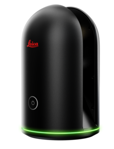
Leica BLK3D
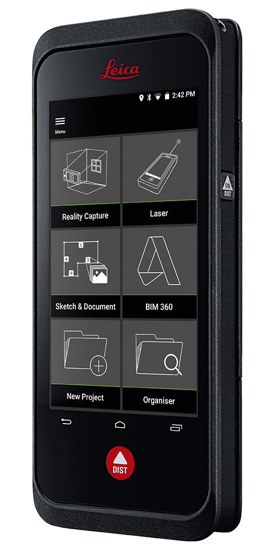
New to BLK3D?
The BLK3D is Leica’s real-time, in-picture 3D measurement solution.
By combining measurement sensors, software, and on-device edge data processing capabilities, the Leica BLK3D makes in-picture measurements with professional-grade accuracy in real-time possible. Every image captured is a complete and precise 3D measurement record.
With the increasing complexity of construction projects and massive amounts of information generated, interoperability with various information systems and industry standards is a requirement for project success.
Contact us to learn more about the connectivity between Leica Geosystems solutions to your Autodesk platform for a more streamlined, efficient construction workflow.

