
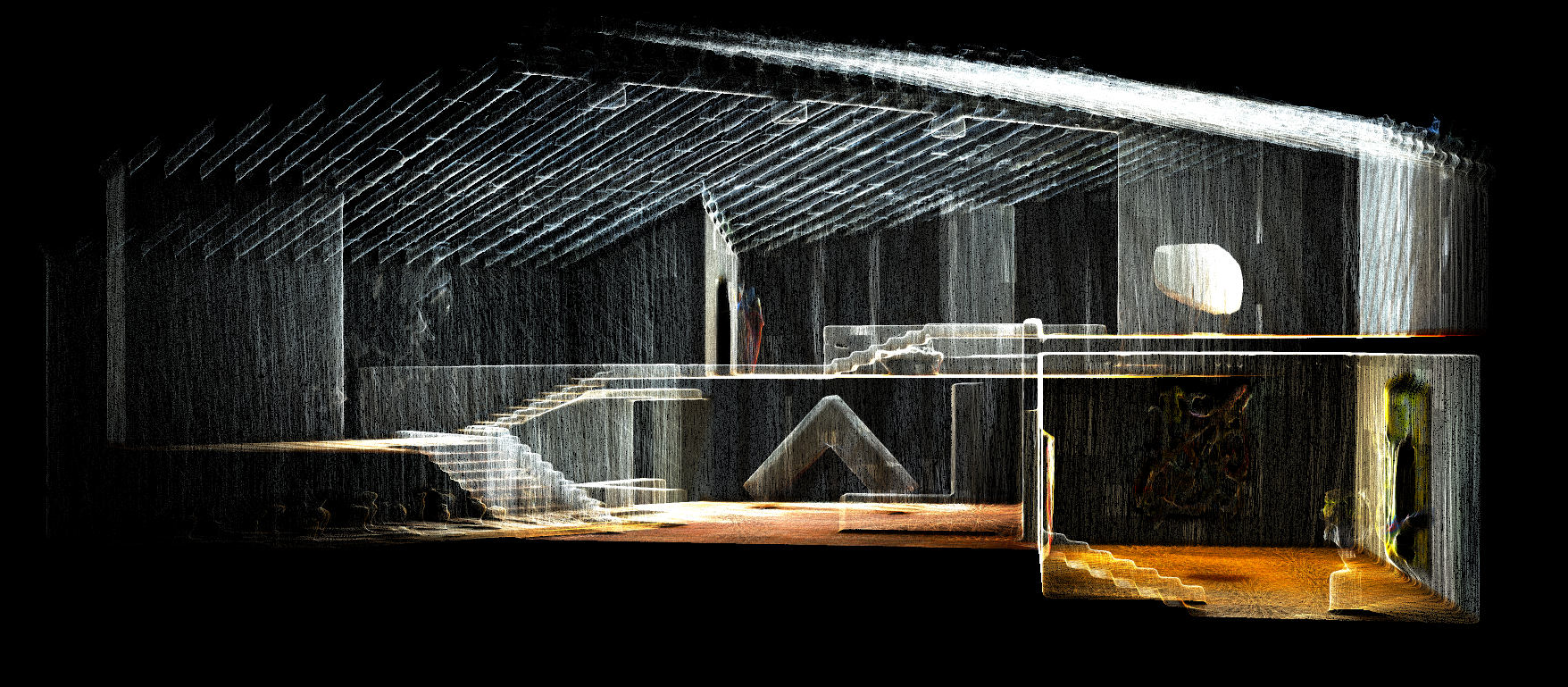
Reality capture technology has proven to offer architects and design teams greater design accuracy at the start of a construction or renovation project by providing a complete and accurate data set of the situation or landscape in the form of actionable 3D data model.
By gaining a precise and clear understanding of site restrictions and challenges, construction and engineering professionals can manage projects more efficiently by being better prepared to respond to problems at the early stages of the project – contributing to more efficient workflows, reduced rework, less delays & site visits, and projects completed on-schedule.
Explore Helpful Insights for Utilizing Reality Capture in Building Construction
The Best-in-Class for your Reality Capture Workflow
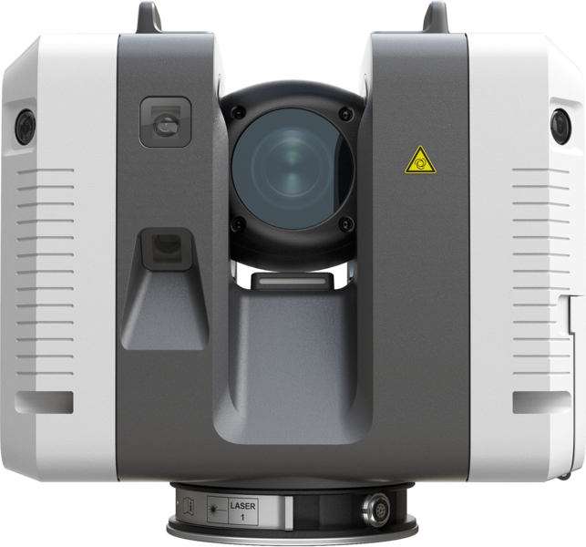
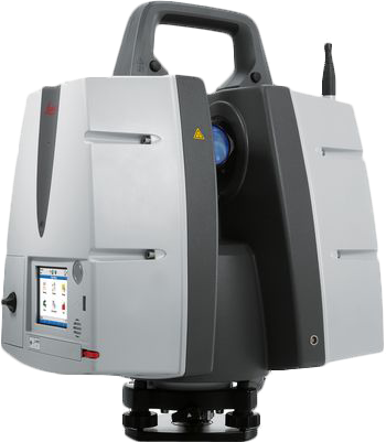
Leica Geosystems’ laser scanners are the perfect partner for your 3D reality capture tasks, delivering survey-grade imagery, outstanding range, speed and highest quality 3D data.
High-Performance Laser Scanners

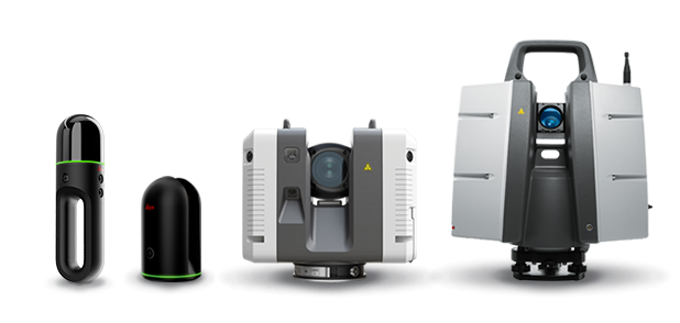
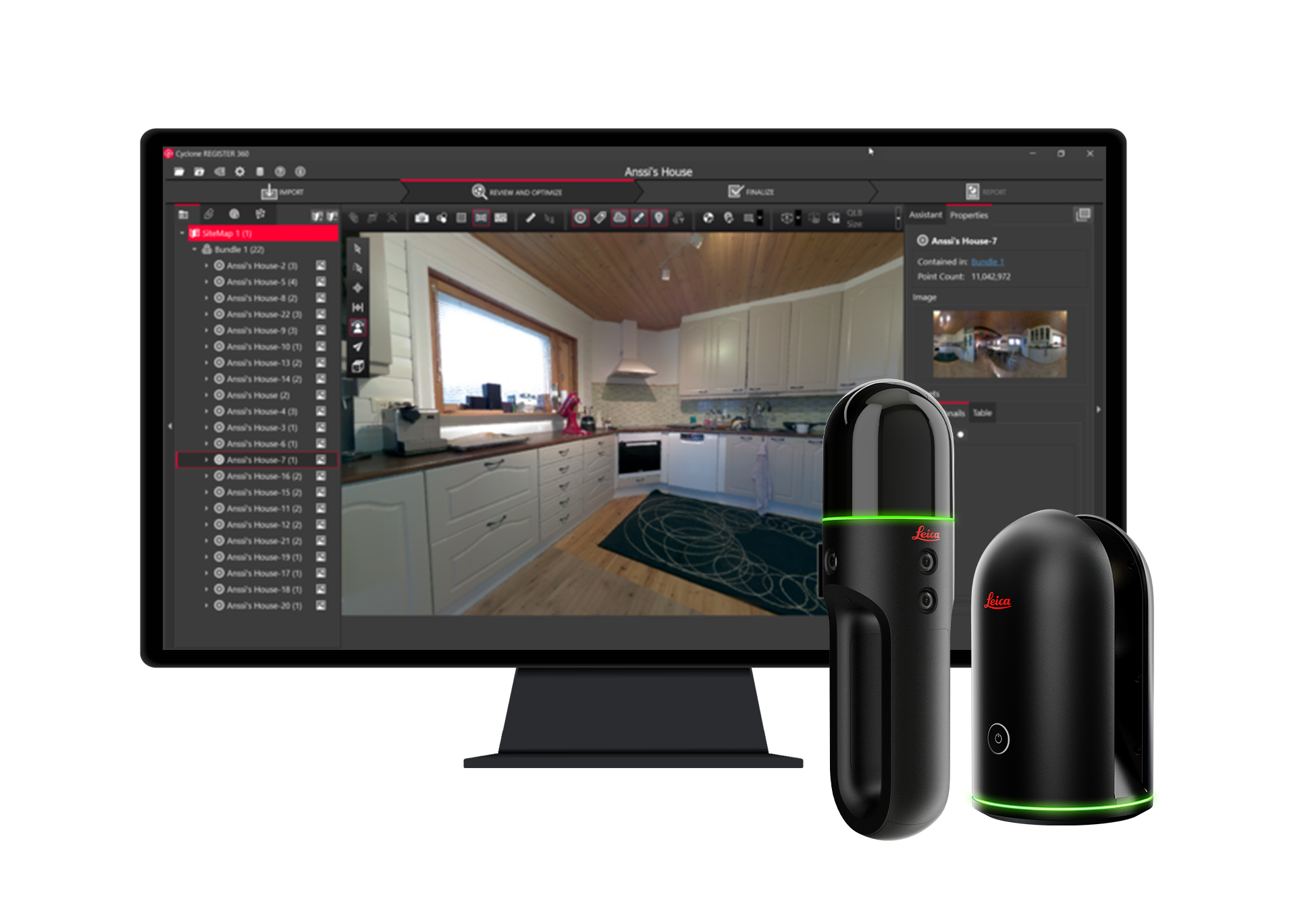
Leica BLK2GO Handheld Imaging Laser Scanner
The BLK2GO handheld imaging laser scanner recreates spaces in 3D as you move. It captures images and dimensionally accurate point clouds in real-time and uses SLAM technology to record your trajectory through space.
Speed
Scan as you go with no interruptions
Seamless
Auto-build 3D point data & imagery while in motion
Dual AXis Lidar
Accurately scans up to 420,000 points per second
MultiCamera vision
12 megapixel detail camera for brilliant high-contrast imagery
Which 3D Laser Scanner is right for you?
Need help deciding which laser scanner to use? Download our Laser Scanning Comparison Chart
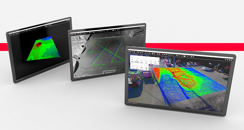
Integrated Software Solutions for Every Reality Capture Workflow
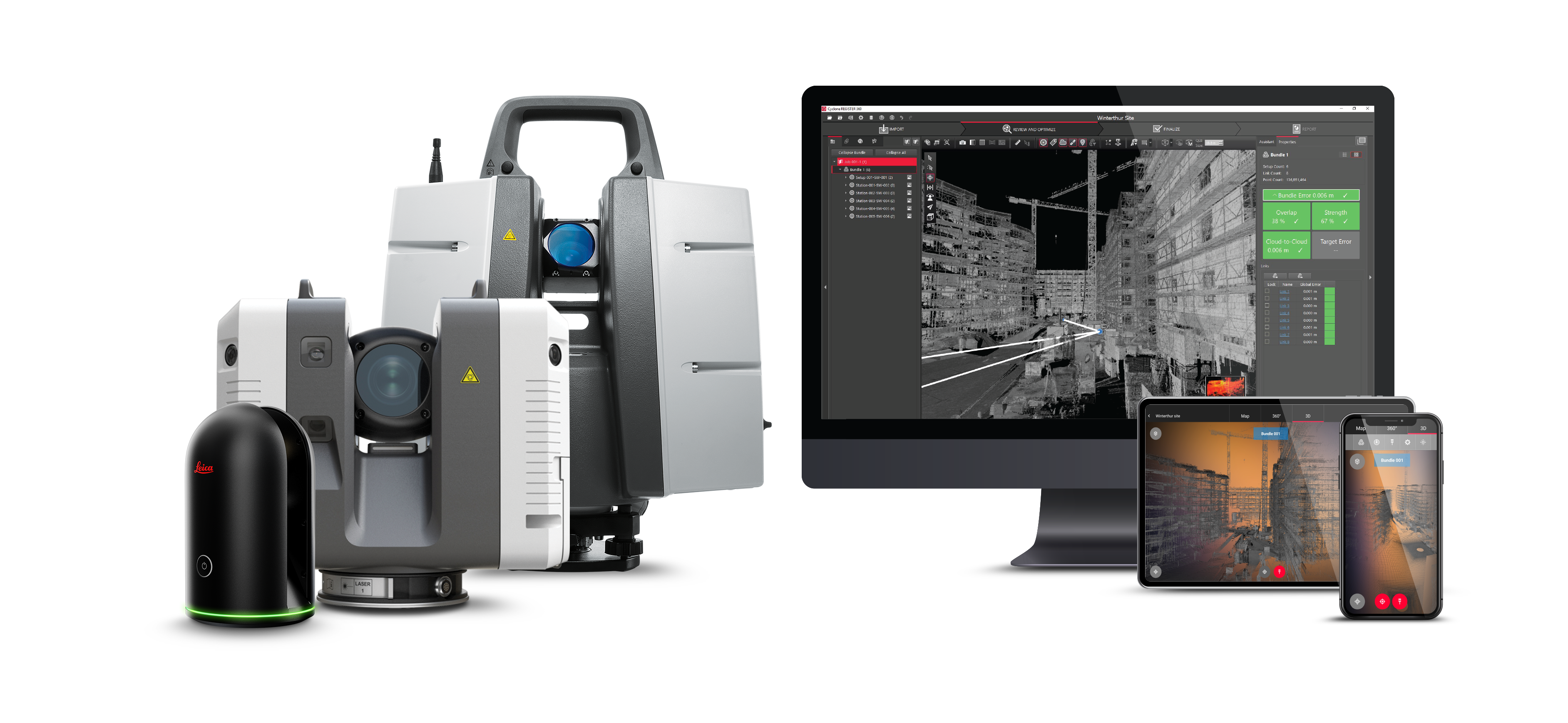
Leica Geosystems reality capture software suite sets the industry standard to capture, visualize, export, analyze, share and represent point cloud data as rich 3D virtual models
Powerful 3D data processing
Powered by JetStream Technology
JetStream technology is a collection of core Leica Geosystems’ reality capture software technology components, bringing added value beyond just point clouds and imagery to the market’s best-in-class workflows. Powered by JetStream partner products range from in-field applications to automated Building Information Modeling (BIM) extraction and specialty data analysis – super-charging your solutions and optimizing your reality capture workflows.
Pointfuse powered by JetStream
PointFuse powered by JetStream, bridges the gap between reality capture and digital construction. Automatically convert point cloud data, including the LGS format and all other popular file formats, into intelligent as-built mesh models that can be classified and used in any industry CAD or BIM system.
From these classified meshes, PointFuse automatically creates Revit family place holders for walls, doors and windows. With specialized settings for Leica Geosystems sensors, PointFuse powered by JetStream is an ideal companion for the Leica BLK2GO and BLK360 as a streamlined solution for creating LOD200 BIM used with BIM and CAFM systems.
-
Automatic point cloud-to-mesh conversion
-
Integration with LGS format
-
Automatic segmentation
Verity powered by JetStream
Verity powered by JetStream provides you the fastest solution for completing construction QA/QC tasks on the market. Verity powered by JetStream takes ClearEdge3D’s Verity and supercharges it with the power of Leica’s JetStream technology.
Across the office or across the country, Verity powered by JetStream enables BIM Managers, VDC Coordinators and Departments to verify 100% of work in the time it takes to spot check 5% – getting results faster than ever while eliminating the need to time-consuming file exports.
-
Sophisticated QA/QC computer vision algorithm for accurate verification
-
Easily share variance data with stakeholders for immediate remediation
-
Automatic creation of true as-built model
Rithm powered by JetStream
Rithm powered by JetStream brings the powerful Rithm workflow into the Leica JetStream ecosystem to capture, understand and quickly deliver QA/QC visualization from laser scan data – providing insights on deviation analysis for steel beams, plus slabs and concrete decks to national standards.
Rithm powered by JetStream gives project teams unmatched clarity to measure elevation deviation for cut/fill calculations, allowing for a clearer picture of jobsite status and simpler reporting for project stakeholders.
-
View exported heat maps directly on architectural drawings
-
Go from data capture to FF/FL inspection (ASTM1155 compliant) in less than 5 mins
-
Unmatched clarity for measuring elevation deviation for cut/fil calculations
A Smarter Way to View the World
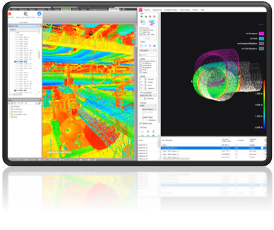
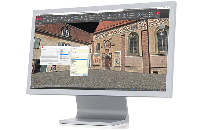
Leica Cyclone for 3D Point Cloud Data
Your total point cloud delivery solution
Leica Cyclone is the market-leading point cloud processing software for 3D laser scanning projects in engineering, surveying, and construction applications.
Leica Cyclone offers a complete solution for delivering point cloud data on the entire set of project requirements from start to finish, including as-built 3D models and maps, rich QA/QC adjustment and analysis tools, topographic surveys, and survey-grade data collection and registration.
Simplified enterprise-level management & collaboration
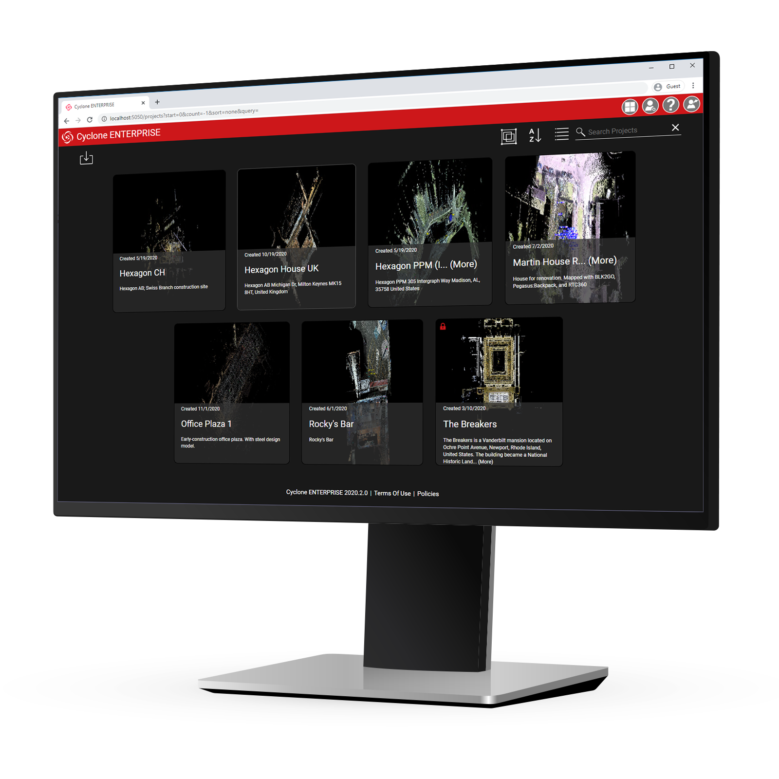
Cyclone Enterprise
Delivering a simplified enterprise-level management and collaboration platform, Leica Cyclone ENTERPRISE enables users to work collaboratively from the same project eliminating the need for confusing duplication of files that can result in mistakes and rework.
Users around the office or around the world can connect to Cyclone ENTERPRISE to produce deliverables in desktop programs such as CloudWorx, and collaborate in TruView with a common project view.
Simple Collaboration
View and edit GeoTags and assets created upstream plus add new Snapshots and Markups to communicate with other users working in the viewer or in CAD applications via Leica CloudWorx.
Web & Desktop Access
With Leica TruView built into the heart of the product, users can access their projects from anywhere, anytime on any device via the browser viewer or via the desktop viewer. This flexibility allows you to view projects, conduct simple data queries and more, while syncing any changes back to the project in real time.
Secure Access
Provide access to users on a group, sub-group or project basis through Cyclone ENTERPRISE so you have confidence in the security of your data. Users gain safe, secure access from anywhere on any device.
JetStream Ecosystem
Cyclone ENTERPRISE is the heart of the JetStream ecosystem, allowing users to stream projects into dozens of products including TruView, Cyclone 3DR and third-party CAD packages like AutoCAD, Revit, BricsCAD and more through CloudWorx plugins. Cyclone ENTERPRISE enables cross-platform collaboration.
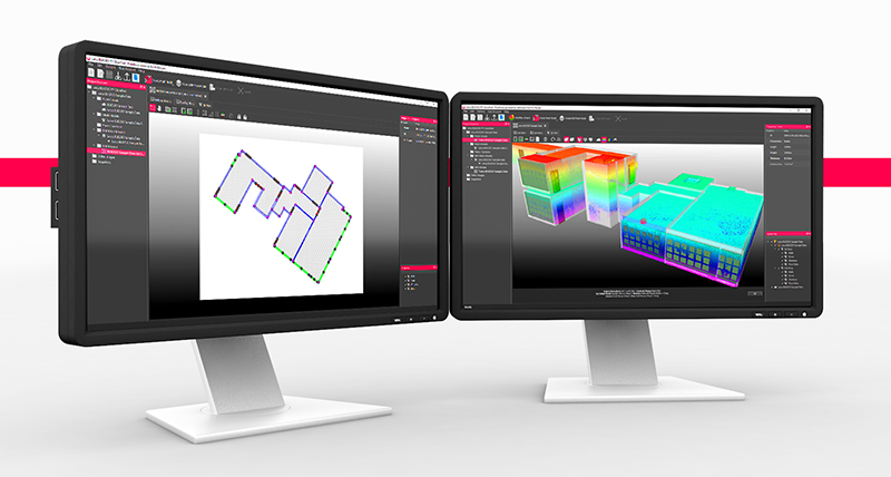
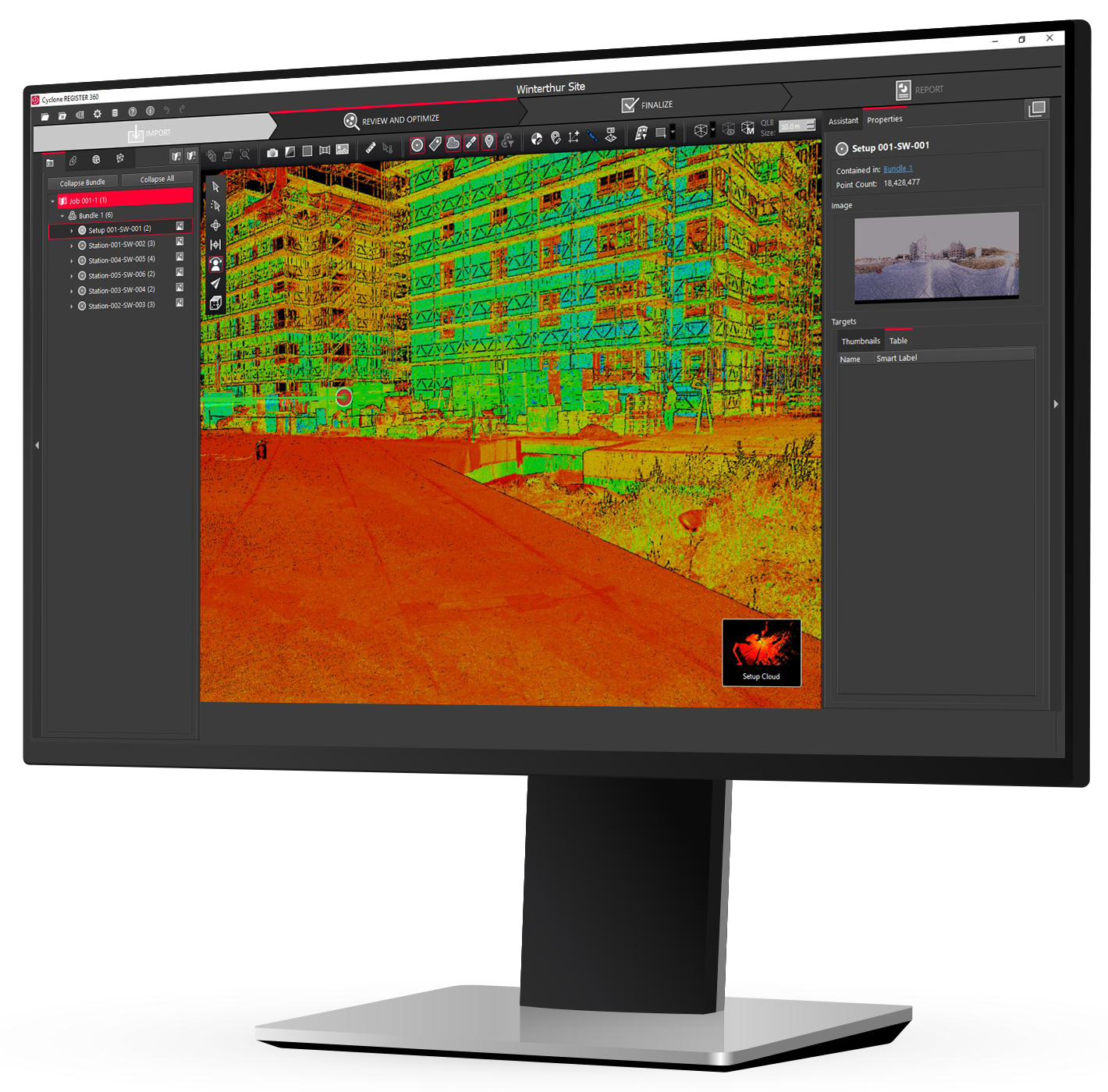
Simple & Robust Point Cloud Registration
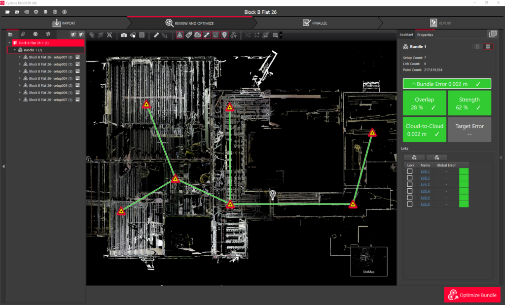
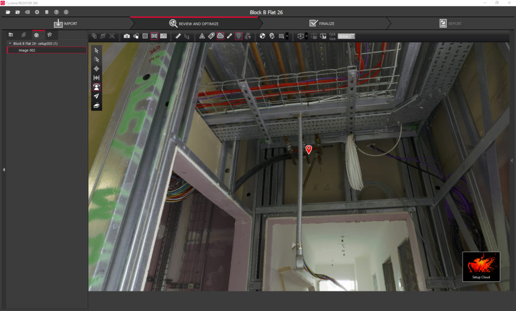
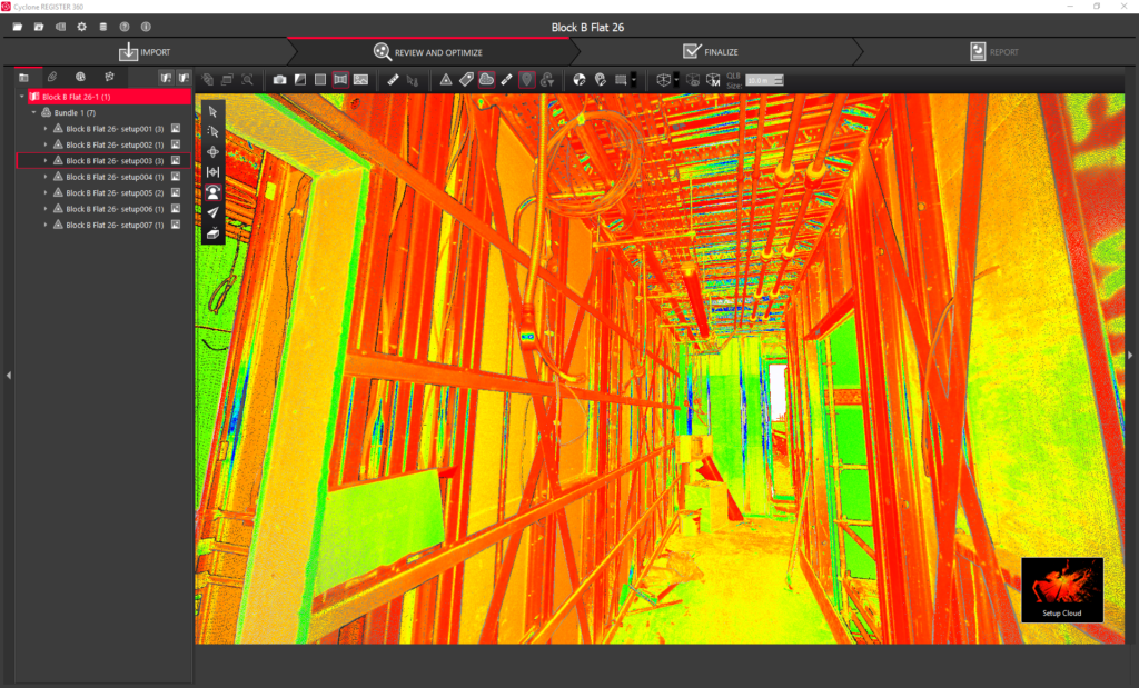
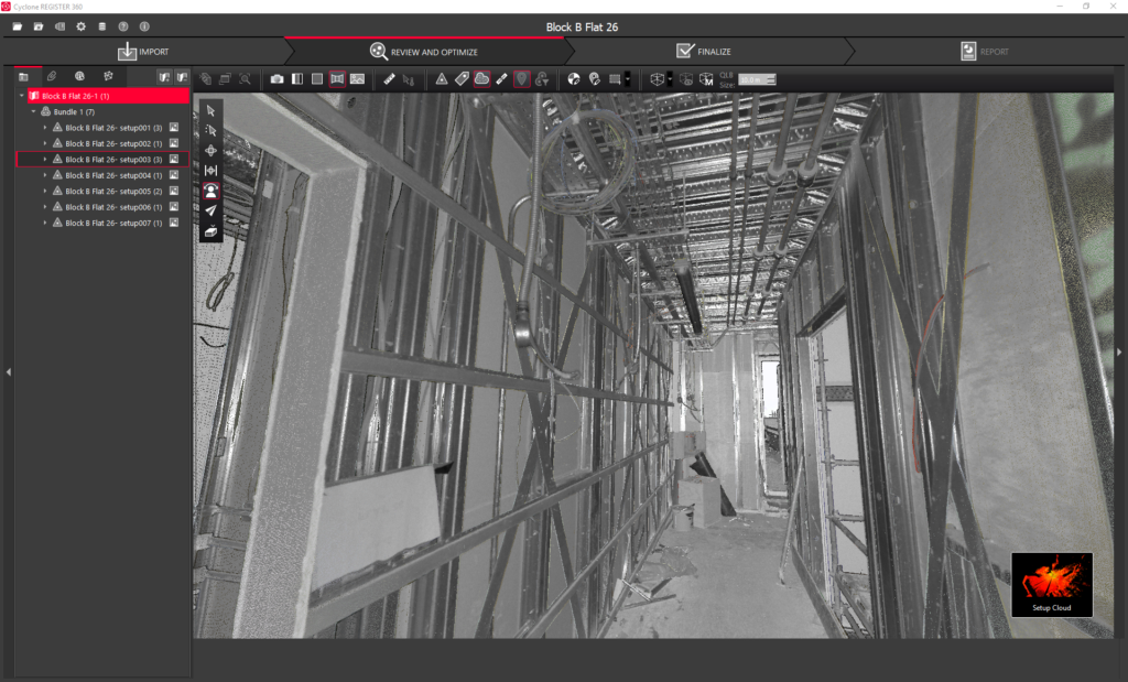
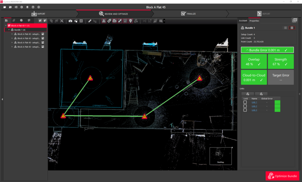
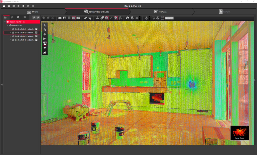
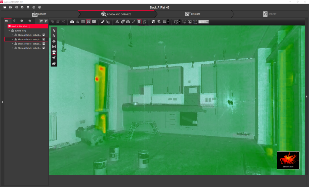
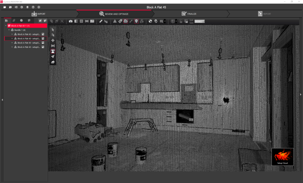
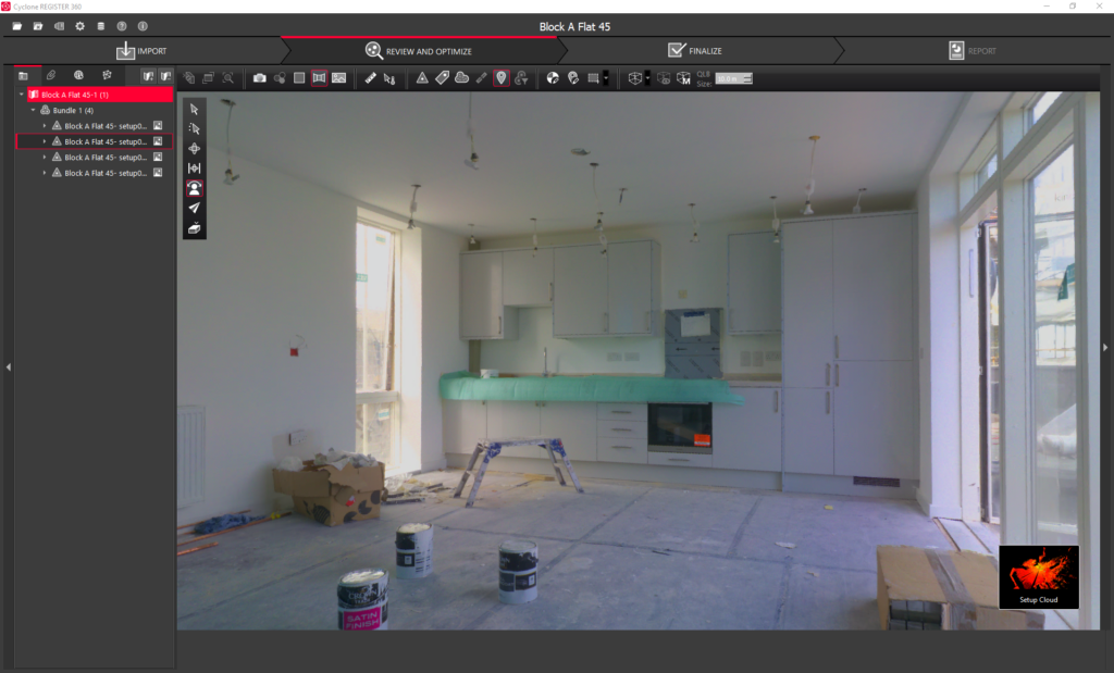
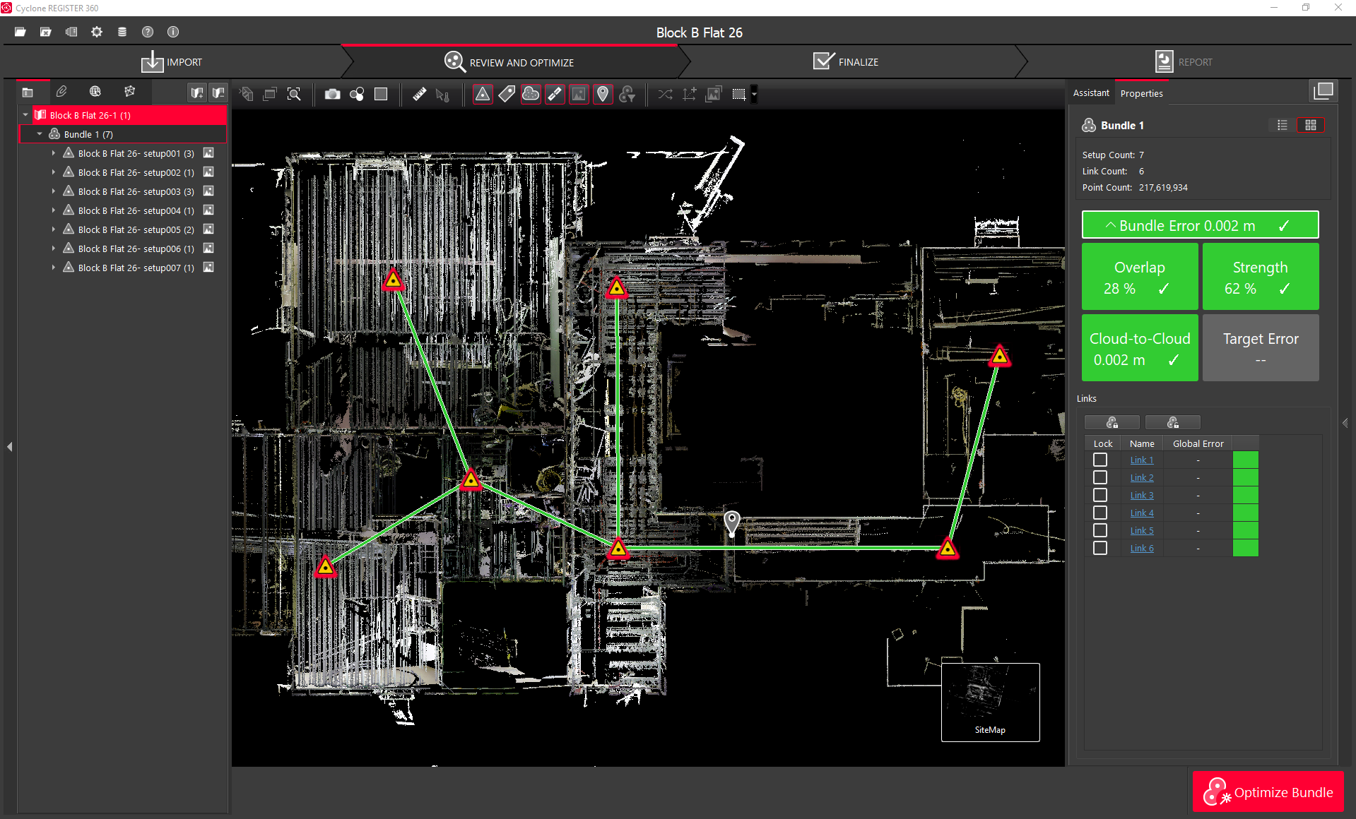
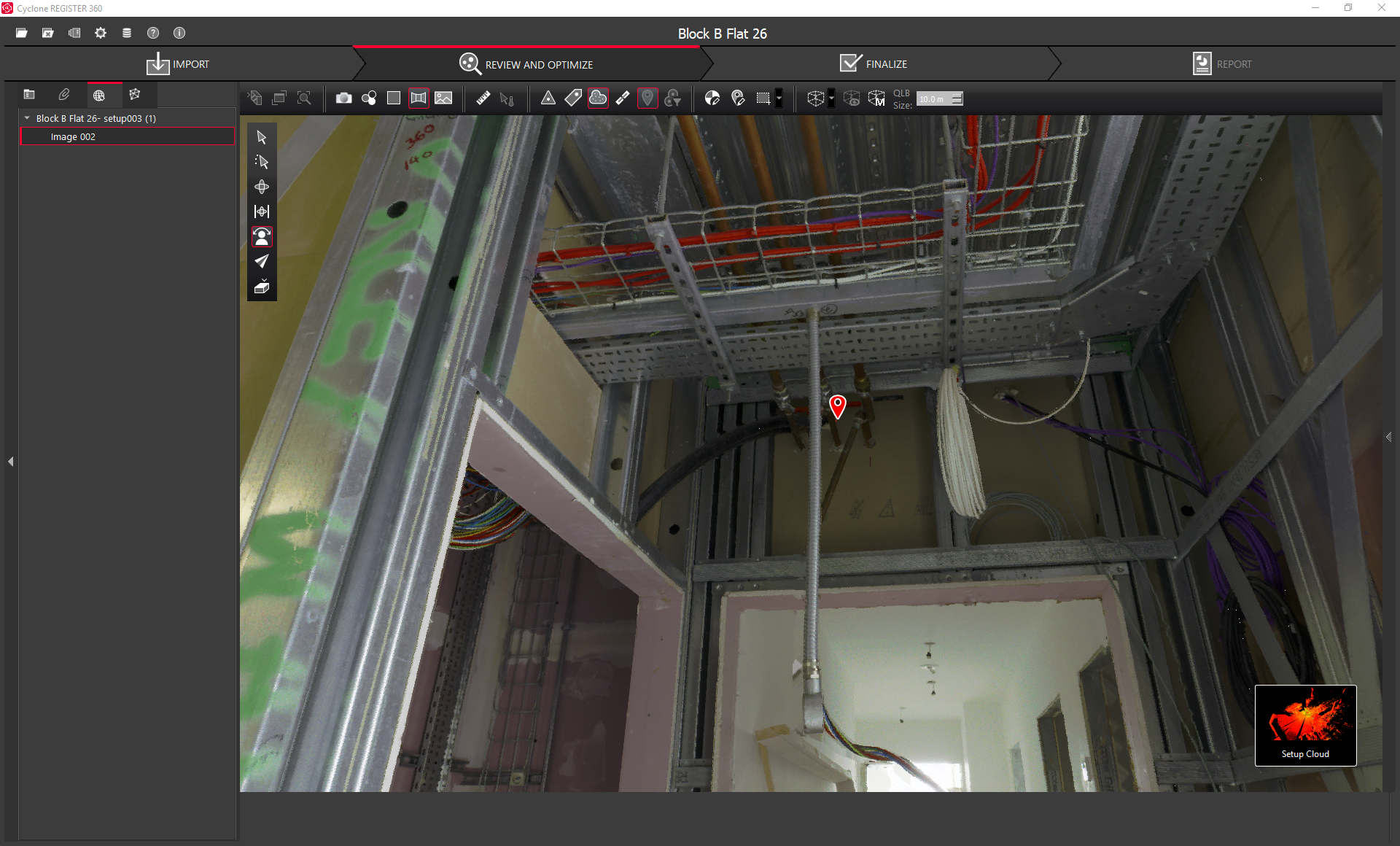
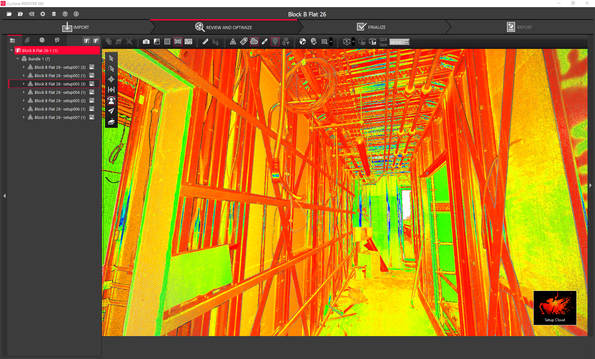
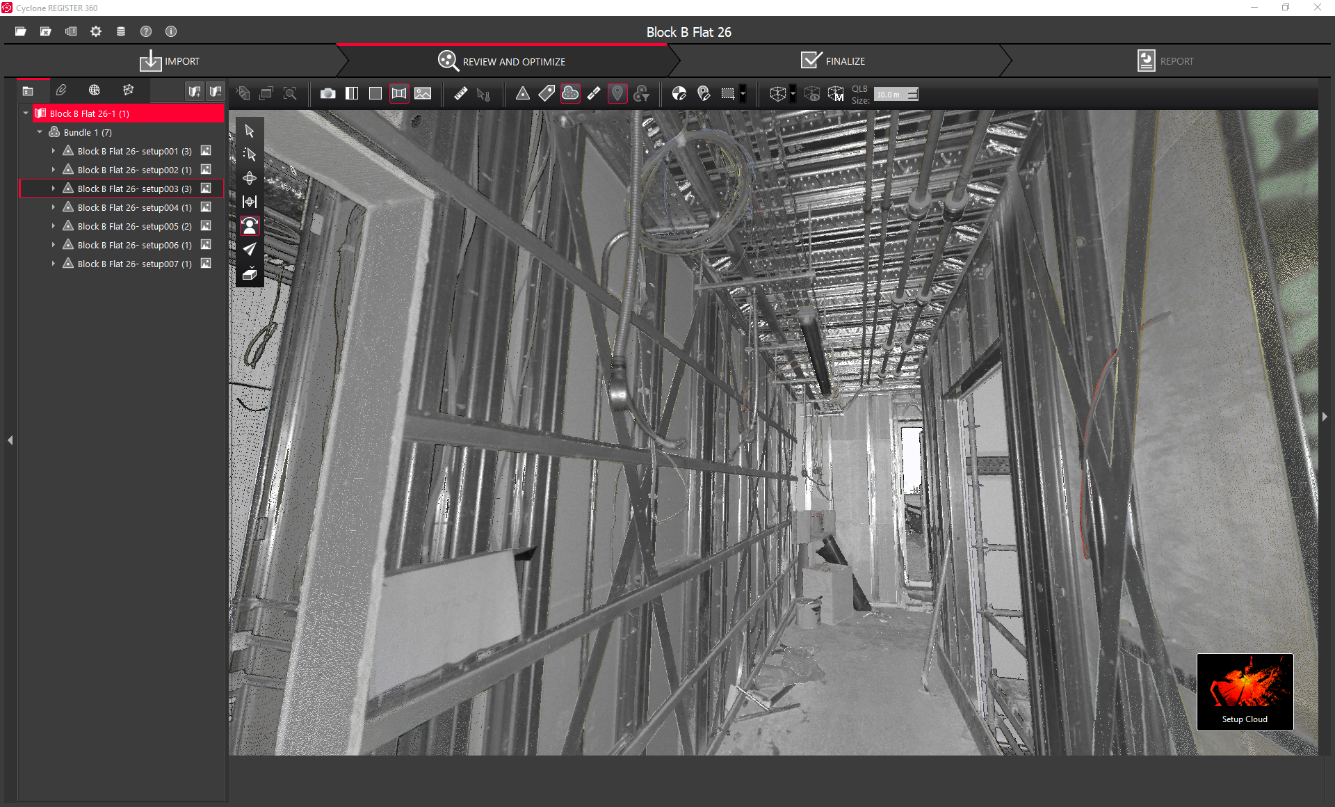
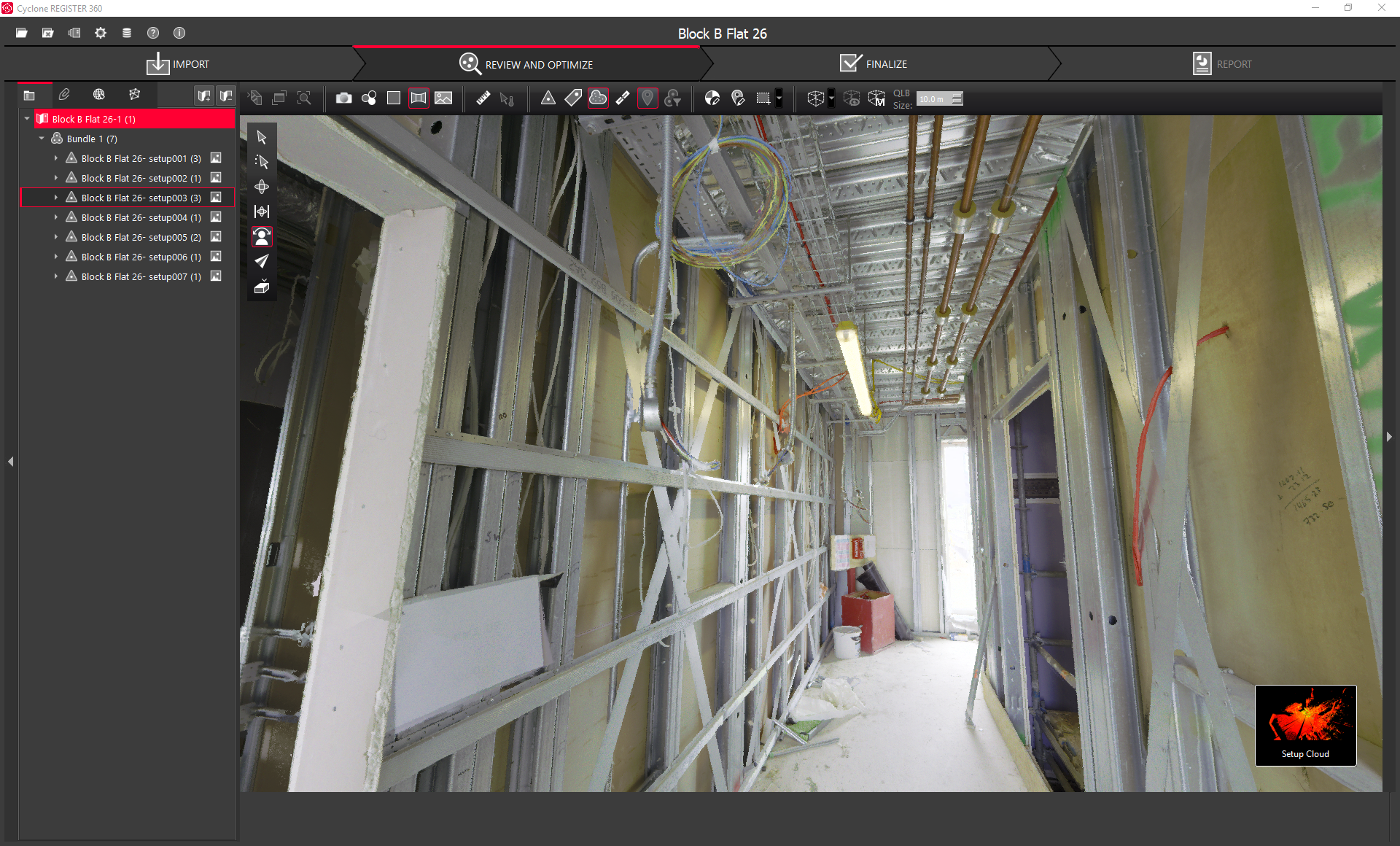
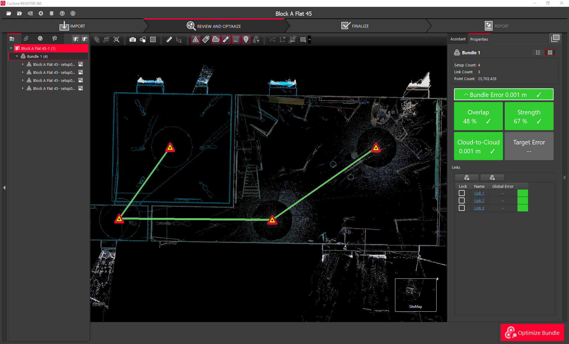
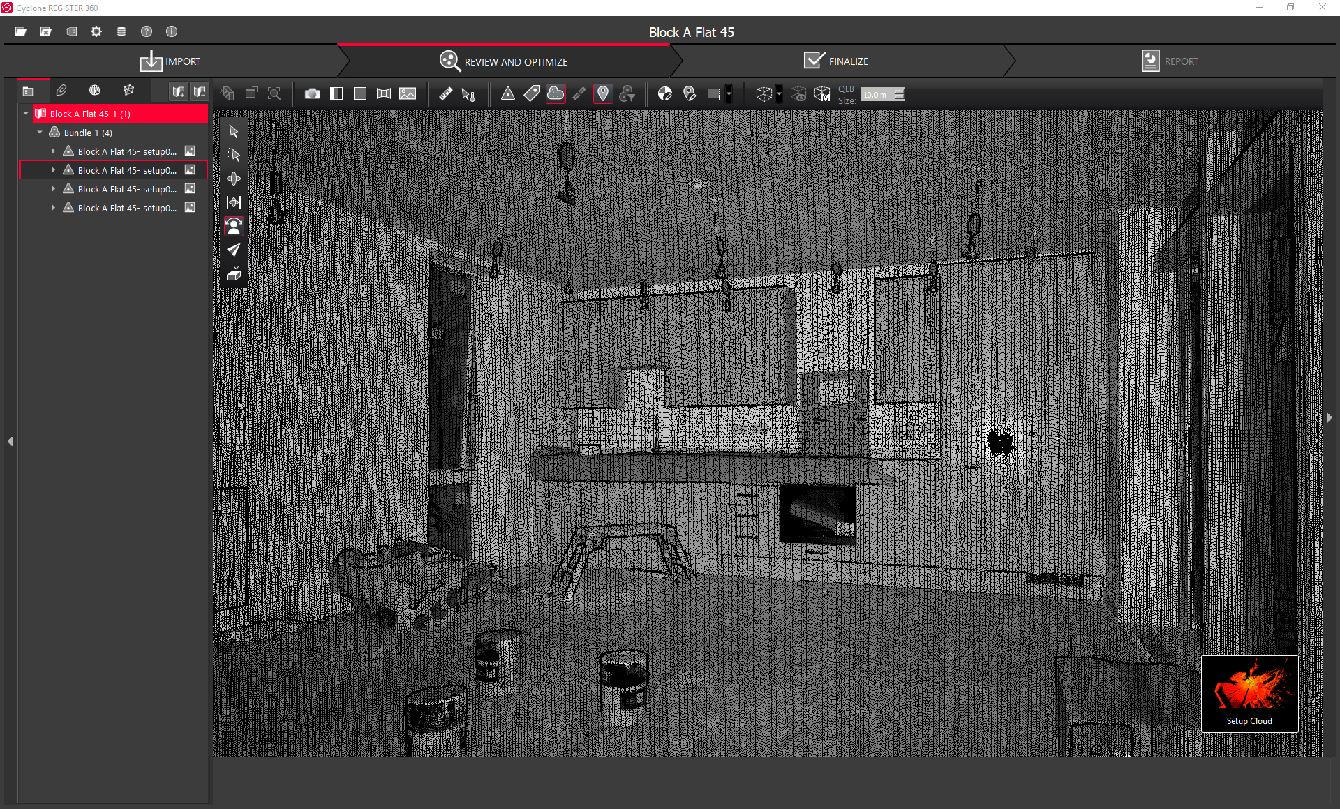
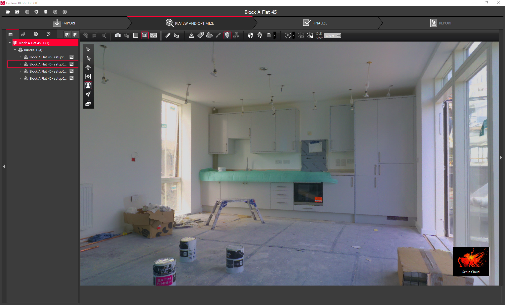
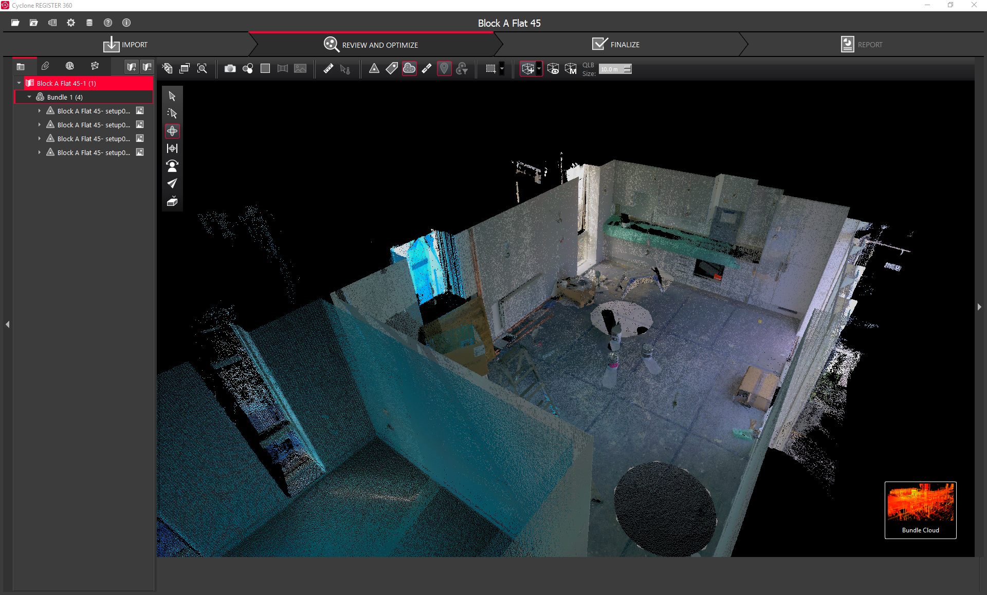
Cyclone REGISTER 360
Leica Cyclone REGISTER 360, the latest upgrade to Cyclone REGISTER, empowers users of any skill level to work smarter, deliver results more accurately, visualize in more detail and collaborate more effectively – placing users at the center of their projects.
Whether deployed as a stand-alone solution or as part of an end-to-end integrated digital reality solution, Cyclone REGISTER 360 is your fastest and easiest option to get the job done right, the first time.


A Superior Field-to-Office Workflow
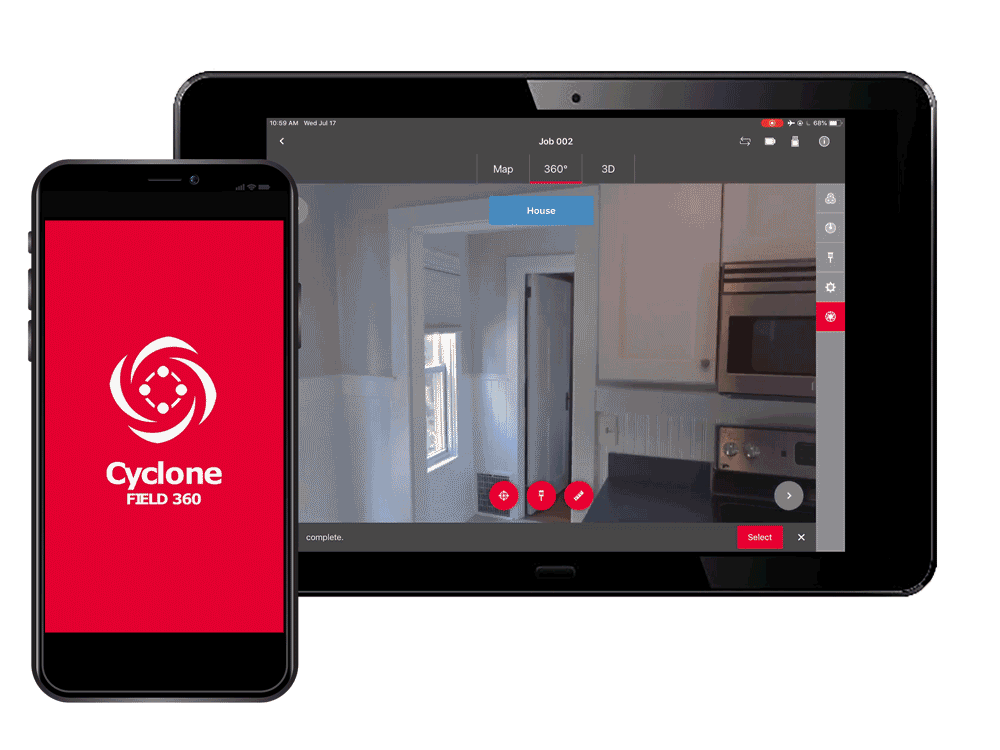
Leica Cyclone FIELD 360 App
Leica Cyclone FIELD 360 mobile-device app links the 3D data acquisition directly in the field with the RTC360 laser scanner, ScanStation P30/P40 and P50 survey-grade laser scanners, or BLK360 imaging laser scanner and the final data registration with Leica Cyclone REGISTER 360 post-processing office software.
On-site the user can automatically capture, register and examine scan and image data. The user interface combines easy handling of complex calculations with a graphical user guidance which offers a remarkable user experience also for novice users.
View Full 3D Model
With its intuitive user interface, remote scanner control and on-site point cloud display, navigation is a breeze with full imagery and point cloud data delivered directly to a tablet using edge computing technology – even for novice users.
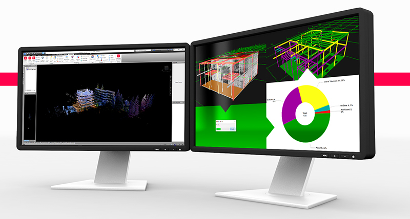
Perform QA/QC Checks
Automatically pre-registered point cloud data enables users to quickly conduct on-site quality control checks and publish your captured data from Cyclone FIELD 360 directly to Leica TruView Cloud for quickly exchanging project information prior to import and registration.
Add Tags to Data
Cyclone FIELD 360 enables on-site tagging of measurements, videos, images, text or voice files to the point cloud geometry simply by using a tablet or smartphone – adding extra value and information to 3D data.
Increased speed & efficiency for CAD systems
CloudWorx Ultimate for CAD Workflows
Leica CloudWorx Ultimate delivers your point cloud projects directly into all your favorite CAD . Access the power of CloudWorx for AutoCAD, MultiWorx for AutoCAD, CloudWorx for MicroStation, CloudWorx for Revit, CloudWorx for Navisworks, and CloudWorx for PDMS with a single, simple license to bring increased speed and efficiency to your multi-platform workflows.
CloudWorx for AutoCAD, Revit, Navisowrks and MultiWorx support Leica Geosystems universal digital reality file, the LGS file allowing you to harness the speed of JetStream plus all your project data—Layers, GeoTags and Clips included—with a single file.
Speed
Easily work between CAD systems, producing drawings and models, performing design verification, or conducting design with the same digital reality content. Gain the benefit of higher point cloud performance when combined with Leica JetStream Enterprise.
Scale
Unlimited in every sense. Handle projects and point clouds of any size, across all supported CAD systems to create deliverables more simply and deliver projects more efficiently to clients and stakeholders. All with a single, ultimate license.
Simplicity
CloudWorx Ultimate works with all your existing CloudWorx plugins to allow you to work with large data sets from Leica Cyclone and Leica JetStream point cloud sources to eliminate tedious export/import transfers.
CloudWorx Suite for all your CAD Systems
Click icons to download more information

