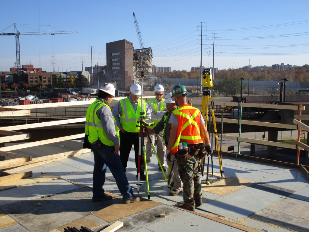
 Facchina Construction Company, one of the most respected contractors in the Washington D.C. area, has been using building information modeling (BIM) since 2011, but a few years ago the firm jumped into the process with both feet. The company was tasked with handling a 20-story, 500,000 square foot above grade office structure located just outside of D.C. that presented numerous challenges. Though the south face of the building is on a radius grid line, the slab edge is faceted and complex. The project also includes numerous sloping columns with an offset orientation.
“Previously we had been using 3D models for early detection of missing or conflicting information and other potential problems in the 2D drawings by modeling the geometry of buildings,” said Scott Hover, Facchina’s BIM manager. “Now we are using BIM, not only for RFI and design clashes, but also for creating 4D schedules, quantity checks when ordering concrete, providing column schedules with accurate heights for field use and integrating field survey.”
Facchina is using BIM for layout and to participate in virtual design coordination efforts. So far, both the field teams and the back office are impressed with the results.
“At the most basic level, our crews in the field now have a visual picture of what they are framing up, wherever they are working, rather than just taking direction from layout engineers or a foreman,” said Hover. “Now they can actually see it, which makes a huge difference.”
A DIFFERENT VIEW FROM THE FIELD
Facchina is using Leica iCON robotic total stations and Leica iCON tablets – both of which they purchased for this specific job.
“With the Leica system, I have three permanent targets on the jobsite,” said Melvin Nolasco, Facchina’s field engineer in charge of layout for the concrete frames division. “I can set up the total station with just one click using the set-up pilot feature, which is a huge timesaver.”
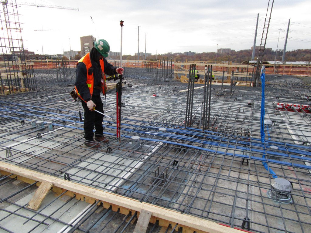 Point layout software is used to create the points in the model, which are then e-mailed to the layout engineer. He then copies the files to a USB stick and loads them onto his Leica tablet in the field to create the layout.
“We don’t even have to stop working or take the tablet to the office,” said Nolasco. “We just put the files into the data collector and keep working.”
On its next project, the firm plans to enable the jobsite with wifi so that files can be sent directly to the tablet.
Not only has BIM made the construction process more efficient, but it has also been very cost effective. Scheduling and material estimates are more accurate, and reworks have been drastically reduced because potential clashes can be detected before construction.
“Rework has been reduced,” Hover said. “Another big benefit has been the ability for everyone – from the field all the way to the supervisor level – to plan months ahead. That has been invaluable.”
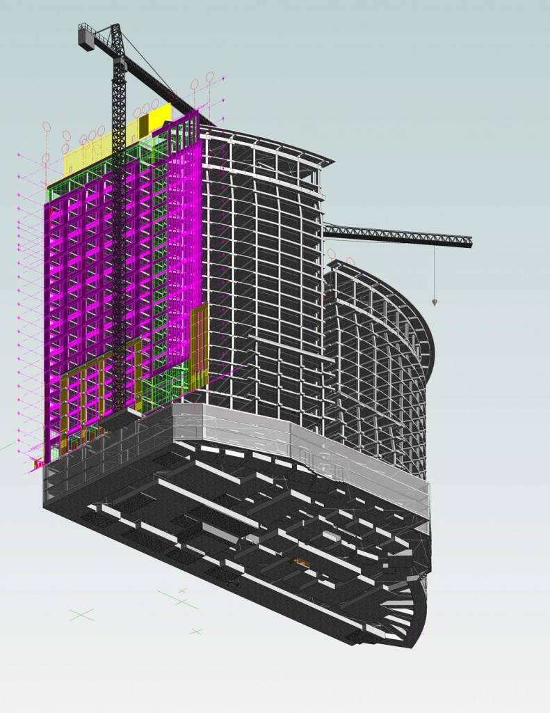
On this project, the design team is producing a 3D construction model, broken apart by approved pour sequencing, for the concrete layout including slab opening, column location and slab edge.
“The very early return on investment on the equipment is being able to find conflicts within the drawings,” said Hover. “I have the opportunity to build in a virtual environment before we mobilized anyone to the jobsite. If I find potential clashes that can impact cost and the schedule months in advance before our guys even get out there, it pays for itself. That in itself is worth the investment in the hardware and software.”
WHAT’S NEXT?
 Facchina has been so impressed with the results that they plan to purchase another robotic total station this year and extend their use of BIM beyond layout to include 4D scheduling.
“With 4D scheduling, we can check the logic of the project manager’s schedule because you can see the planned activities in real time,” said Hover. “We’ve even heard of people doing 5D schedules where they can cost load the model.”
Hover said that as it becomes more commonplace to use BIM in the industry, more and more general contractors are requiring subcontractors to participate in their virtual design efforts. This has required field crews to learn some new skill sets.
“At the very beginning, there was some resistance, which is natural when there is a change in the workflow. But now that our teams have seen what BIM can do and have been trained on how to use it, just about everyone from the CEO to the foremen see the value,” Hover said. “A lot of our layout engineers are even interested in doing some of their own 3D work for their own layouts.”
 In early 2012, Frazier Masonry Corporation of Lancaster, Calif., became one of the first multi-state concrete companies to adopt robotic total station technology for standard layout tasks. “It’s our policy to be progressive—we used laser screeds early on, for example,” explains Vice President of Concrete Mike Prascsak. “We make that part of our presentations and interviews when preparing bids. Now, when we explain that we’re using the same tools as surveyors to set out points, and that we can even reset lost points if needed, contractors are amazed.”
 This way of working offers many advantages, compared to string-lines and tape measures. The most obvious, of course, is the fact that most layout work can be done faster, and with one man, rather than a two-man crew. “On one of our most recent projects, a 30,000 square foot building, we had a total of 1,027 points to set—that includes footing edges, pier locations, bolt locations… everything—and one man, working with the robot, was able to do the work in two days,” says Prascsak. “With our previous methods, that would have taken three days, with a two-man crew. Especially on large buildings, there’s a very clear return on investment.”
 Additional advantages are real, but subtler. For example, Prascsak says that because layout is more accurate, final results are better too; “We’ve always done very accurate work, so it’s not a dramatic improvement,” he says. “But, at the end of the day, if our floors are even a little flatter, that’s a very good thing.” And, use of the robotic instrument is leveraging Frazier’s previous investments in 3D CAD modeling, and may eventually lead to new services—“We keep learning how to do more with the system,” says Prascsak, “and that may enable us to do new kinds of work, like machine control.”
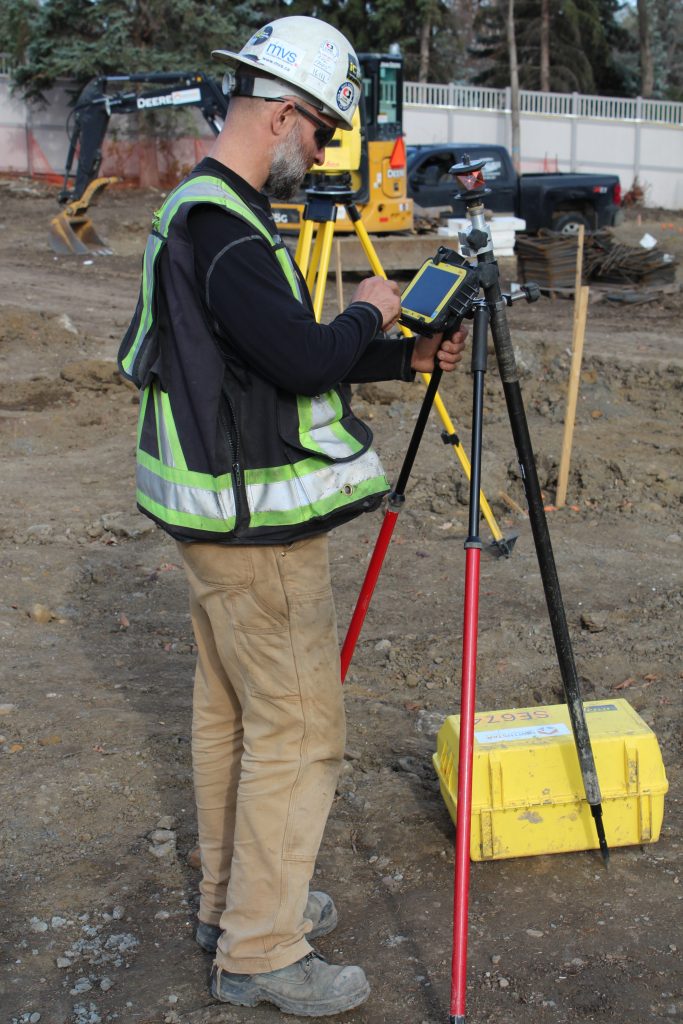 Ninety to 100 points an hour – that’s how fast Jeff Gerber and the surveyors of
 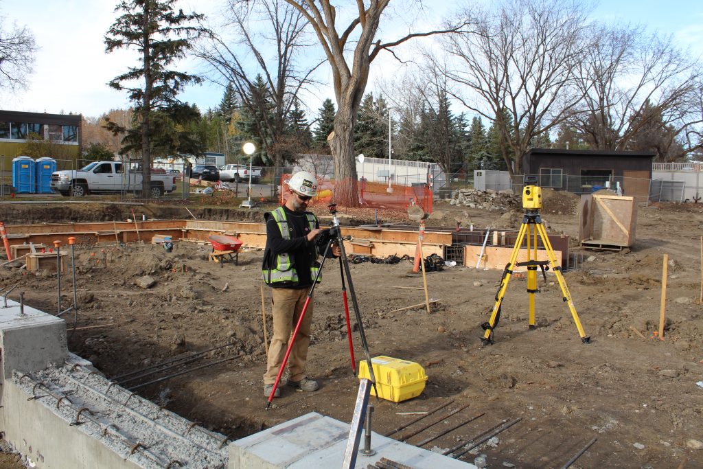 As Gerber and the other surveyors at Clark Builders have continued to push the limits of the iCON solution, they have discovered other advantages. For example, the ease of laying out surfaces and slope lines has enabled the team to pursue increasingly complex projects. “It’s so much easier to do advanced work with angles and curves,” Gerber said. “It’s given us a huge boost of confidence.”
