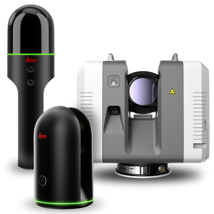
Reality Capture for Building Design & Construction

Reality capture technology has proven to offer architects and design teams greater design accuracy at the start of a construction or renovation project by providing a complete and accurate data set of the situation or landscape in the form of actionable 3D data model.

By gaining a precise and clear understanding of site restrictions and challenges, construction and engineering professionals can manage projects more efficiently by being better prepared to respond to problems at the early stages of the project – contributing to more efficient workflows, reduced rework, less delays & site visits, and projects completed on-schedule.

Explore Helpful Insights for Utilizing Reality Capture in Building Construction

Featured Insights

Spotlight: Leica BLK360

Reality Capture Enables 3D Virtual Tour of Frank Lloyd Wright’s Taliesin West

Anyone wishing to explore Taliesin West, the winter home and desert laboratory of architect Frank Lloyd Wright, can now do so virtually, thanks to the power of reality capture technology. Through a combination of a powerful 3D imaging laser scanner, sophisticated documentation and an immersive media platform, visitors can tour Taliesin West online from every dimension – the exterior grounds and the interior home along with architectural details including 3D views and floorplans.

Technology Captures Every Detail

Created through a partnership between the Frank Lloyd Wright Foundation and Leica Geosystems (part of Hexagon), the visual immersive experience relies on 360º spherical imagery and point cloud data captured with the Leica BLK360, the world’s smallest, fastest and easiest to use 3D imaging laser scanner. The data was compiled by Multivista, a global provider of progressive construction documentation and software services that is also part of Hexagon.

Leica Geosystems’ partner Matterport, an immersive 3D media technology company, provided its Matterport Pro2 camera and cloud platform for the initiative. Both the BLK360 and the Matterport Pro2 camera feed visual data into the Matterport cloud platform, where the Taliesin West virtual tour is located.

The resulting digital reality provides a completely new way to experience Taliesin West. According to the Frank Lloyd Wright Foundation, “The point cloud data is invaluable for the preservation of Taliesin West and can be used to continue its legacy as a living laboratory. The data gathered for this project will inform and inspire the architectural community as well as the students that study here.”

Anyone wishing to explore Taliesin West, the winter home and desert laboratory of architect Frank Lloyd Wright, can now do so virtually, thanks to the power of reality capture technology. Through a combination of a powerful 3D imaging laser scanner, sophisticated documentation and an immersive media platform, visitors can tour Taliesin West online from every dimension – the exterior grounds and the interior home along with architectural details including 3D views and floorplans.

Immersive Experience Heralds the Future of Design

The immersive experience provides a deeper understanding of Frank Lloyd Wright’s philosophy on organic architecture and how it comes to life in the design and structure of his winter home and studio. Importantly, it marks the beginning of a new initiative to capture Wright’s work in digital form for all to experience. The next property that will be available through a virtual tour experience is Taliesin, Wright’s summer home in Wisconsin.

“True to our mission, the Frank Lloyd Wright Foundation is dedicated to preserving Taliesin and Taliesin West for future generations,” said Stuart Graff, president and CEO of the Frank Lloyd Wright Foundation. “Through our partnership with Leica Geosystems, we’re able to carry our mission, and Wright’s vision into the future, by making Taliesin West available to the world so they can experience his ideas, architecture and design in new ways.”
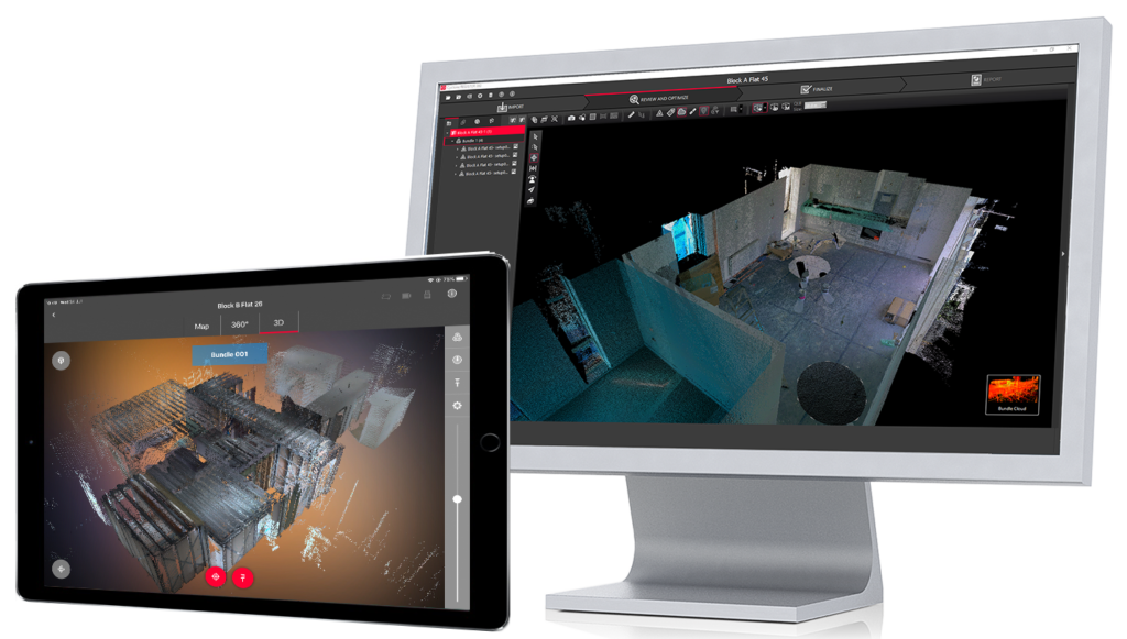
Leica BLK360 imaging laser scanner

This powerful, yet compact scanner features LiDAR technology that captures 360,000 points per second. Three spherical, panoramic HDR cameras with a thermal imaging camera. Delivers 3D point clouds with millimeter accuracy, creating an accurate digital twin of your site with laser-based measurements.

Learn More About the Leica BLK360

Featured Downloads

The Shift to Digital Construction

Download eBook

ATG’s Comprehensive Comparison of Leica’s Mobile Scanning Devices

Download White Paper

Reality Capture for Construction

Download eBook

Customer Insight

WD Partners achieves breakthrough in AEC as-builts with fast, agile, and precise laser scanning

Customer: WD Partners
Workflow: Reality Capture, verification of existing conditions
Scanners: P-Series, BLK360, RTC360
Software: Leica Cyclone

Project Goals:

  • Streamline field-to-office 3D data workflow
  • Increase amount of points captured per scan
  • Produce more accurate as-built data
  • Reduce time and rework required onsite
Read Customer Story

“We’re easily achieving a 60 percent time savings,” said Brandon French, Senior Reality Capture Technician. “And we’re able to deliver information the architects and engineers can work from the very next day, which gives them a huge advantage.”

Integrated Reality Capture Technology Solutions

Software Solutions

Explore our integrated laser scanning software solutions for your point cloud reality capture data workflows

Software Integrations

Explore our powerful and efficient plug-in software for streamlining as-built point cloud data with Autodesk laser scanning workflows

3D Laser Scanners

Our high-performance 3D laser reality capture laser scanners for capturing & registering point cloud data fast

Contact Us

Connect with your local Leica Geosystems reality capture representative